Search Term Record
Metadata
Name |
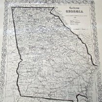
Georgia |
Related Records
-
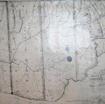
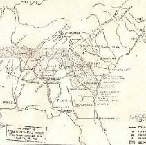
A map of that part of Georgia Occupied by the Cherokee Indians - A map of that part of GA occupied by the Cherokee Indians
1 map: photocopy
Record Type: Archive
-
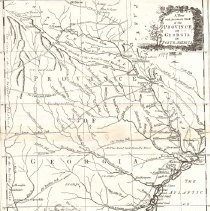
A New and Accurate Map of the Province of Georgia in North America - Georgia
1 map: photocopy
Record Type: Archive
-
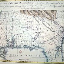
A New Map of Georgia with Part of Carolina, Florida, and Louisiana. - Colonial Georgia and surrounding area.
1 map: color reproduction
Record Type: Archive
-
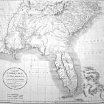
A New Map of Part of the United States of North America, containing the Carolinas and Georgia. Also the Floridas and part of Bahama Islands & Cuba - Southeastern United States, Cuba, Bahama Islands
1 map: photocopy
Record Type: Archive
-
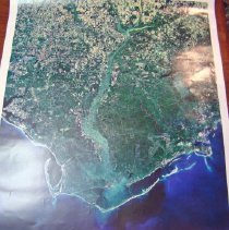
Apalachicola River and Bay Basin Satellite Map - Southeastern U.S.
1 map: color
Record Type: Archive
-
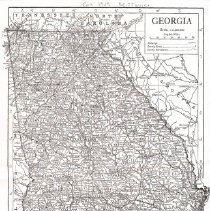
Atlanta, Georgia Dept. of Interior's Geological Survey - Atlanta, Georgia
1 map: color
Record Type: Archive
-
Biographical souvenir of the States of Georgia and Florida : containing biographical sketches of the representative public, and many early settled families in these states.
F285.B56 1889
Record Type: Library

-
-
-
-
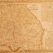
County Map of the States of Georgia and Alabama - Southeast
1 map: color reproduction
Record Type: Archive
-
-
-
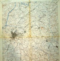
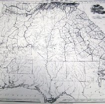
Georgia and the Southeast United States - Georgia and Southeastern United States
1 map: photocopy
Record Type: Archive
-
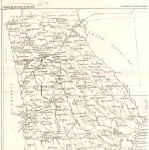
Georgia, Bureau of American Ethnology, 18th Annual Report - Georgia
1 map: photocopy
Record Type: Archive
-
-
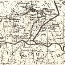
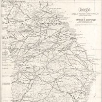
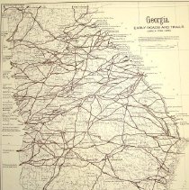
Georgia Early Roads and Trails 1730-1850 - Georgia
1 map: reproduction The Early Road Network has been imposed on a 1932 base map from the United States Department of the Interior. Research of the roads was done by Dr. John H. Goff.
Record Type: Archive
-

-

-
Georgia's bi-centennial memoirs and memories : a tale of two centuries, reviewing the state's marvelous story of achievement, since Oglethorpe's landing in 1733 - Lucian Lamar Knight
F285K697
Record Type: Library